Log in
All resources
Create a design
242 Free Artworks of 1875 Maps
dr. wilh. junker's reisen in afrika 1875-1886
natural history
smithsonian libraries
description and travel
1889 maps of africa
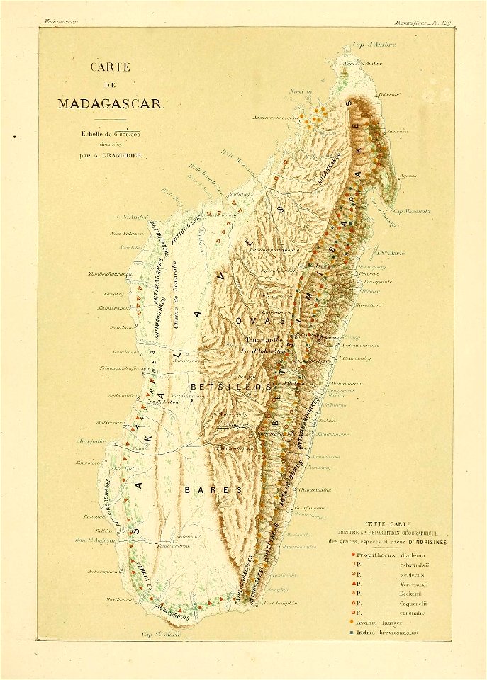
madagascar
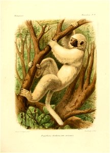
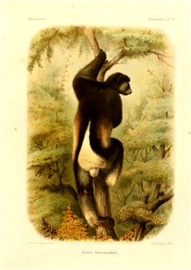
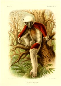
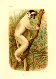
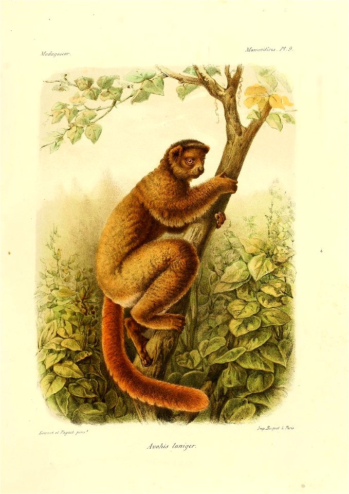
histoire physique, naturelle, et politique de madagascar v.9=t.4 (1875) [mammifères atlas pt.1]
astronomy
geology
united states
old maps of the caucasus
the frosty caucasus
illustrations from the mysterious island by jules férat
maps of the mysterious island
maps from the mechanical curator collection available to georeference
maps from the mechanical curator collection
st. helena - a physical, historical, and topographical description of the island (1875) by melliss
maps from the mechanical curator collection
19th-century maps of russia
russia in the 1860s
maps in the library of congress
1875 maps of california
dr. wilh. junker's reisen in afrika 1875-1886
1889 maps of africa
charles west cope
1875 paintings
eran laor cartographic collection
edward weller
dr. wilh. junker's reisen in afrika 1875-1886
1880s maps of sudan
maps from the earth and its inhabitants, vol. xii
africa in the 1890s
new york and brooklyn, with jersey city and hoboken water front
maps in the library of congress
arctic expeditions from british and foreign shores - from the earliest to the expedition of 1875 (1875)
1870s maps of canada
maps by daniel lizars
1830s maps of belize
topographischer atlas der schweiz
maps of morteratsch glacier
illustrations from the mysterious island by jules férat
maps of the mysterious island
dr. wilh. junker's reisen in afrika 1875-1886
libyan desert
dr. wilh. junker's reisen in afrika 1875-1886
old maps of khartoum
dr. wilh. junker's reisen in afrika 1875-1886
19th-century maps of south sudan
dr. wilh. junker's reisen in afrika 1875-1886
19th-century maps of south sudan
maps by william home lizars
1836 maps of mexico
maps by william home lizars
1836 maps of mexico
1870s maps of kentucky
maps of the ohio river
dr. wilh. junker's reisen in afrika 1875-1886
old maps of lake victoria
dr. wilh. junker's reisen in afrika 1875-1886
bruno hassenstein
bibliothèque nationale de france
noviciat des jésuites (paris)
german renaissance
old maps of venice
dr. wilh. junker's reisen in afrika 1875-1886
1889 maps of sudan
dr. wilh. junker's reisen in afrika 1875-1886
19th-century maps of south sudan
the great south - a record of journeys (1875)
1875 maps of the united states
paris à travers les âges
lithographs of paris
maps by daniel lizars
1831 maps of mexico
the great south - a record of journeys (1875)
1875 maps of the united states
madagascar
maps
herman diederik joan van schevichaven
maps of the history of belgium
herman diederik joan van schevichaven
revolt of the batavi
the great south - a record of journeys (1875)
1875 maps of the united states
dr. wilh. junker's reisen in afrika 1875-1886
1880s maps of egypt
maps of rivers of the democratic republic of the congo
dr. wilh. junker's reisen in afrika 1875-1886
dr. wilh. junker's reisen in afrika 1875-1886
19th-century maps of south sudan
dr. wilh. junker's reisen in afrika 1875-1886
19th-century maps of south sudan
dr. wilh. junker's reisen in afrika 1875-1886
1889 maps of africa
dr. wilh. junker's reisen in afrika 1875-1886
1889 maps of africa
dr. wilh. junker's reisen in afrika 1875-1886
1889 maps of africa
the great south - a record of journeys (1875)
1875 maps of the united states
the great south - a record of journeys (1875)
1875 maps of the united states
dr. wilh. junker's reisen in afrika 1875-1886
1889 maps of africa
dr. wilh. junker's reisen in afrika 1875-1886
19th-century maps of central africa
dr. wilh. junker's reisen in afrika 1875-1886
1889 maps of africa
the great south - a record of journeys (1875)
1875 maps of the united states
dr. wilh. junker's reisen in afrika 1875-1886
1889 maps of africa
dr. wilh. junker's reisen in afrika 1875-1886
1889 maps of africa
dr. wilh. junker's reisen in afrika 1875-1886
1889 maps of africa
dr. wilh. junker's reisen in afrika 1875-1886
1889 maps of africa
dr. wilh. junker's reisen in afrika 1875-1886
1889 maps of africa
dr. wilh. junker's reisen in afrika 1875-1886
19th-century maps of uganda
dr. wilh. junker's reisen in afrika 1875-1886
1889 maps of africa
dr. wilh. junker's reisen in afrika 1875-1886
1889 maps of africa
dr. wilh. junker's reisen in afrika 1875-1886
maps of bahr el ghazal
dr. wilh. junker's reisen in afrika 1875-1886
1889 maps of africa
dr. wilh. junker's reisen in afrika 1875-1886
19th-century maps of the nile river
dr. wilh. junker's reisen in afrika 1875-1886
1889 maps of africa
dr. wilh. junker's reisen in afrika 1875-1886
1889 maps of africa
dr. wilh. junker's reisen in afrika 1875-1886
19th-century maps of uganda
russo-turkish war (1877–1878) in art
great eastern crisis (1875–78)
19th-century maps of the democratic republic of the congo
dr. wilh. junker's reisen in afrika 1875-1886
dr. wilh. junker's reisen in afrika 1875-1886
old maps of lake victoria
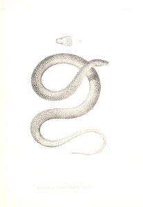
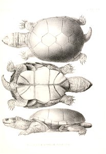
mammals
maps
maps by william home lizars
1836 maps of texas
maps by daniel lizars
1831 maps of mexico
travel
maps
st. helena - a physical, historical, and topographical description of the island (1875) by melliss
old maps of saint helena
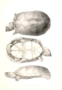
mammals
maps
mammals
maps
mammals
maps
mammals
maps
mammals
maps
mammals
maps
mammals
maps
mammals
maps
mammals
maps
mammals
maps
mammals
maps
dr. wilh. junker's reisen in afrika 1875-1886
19th-century maps of uganda
the great south - a record of journeys (1875)
1870s maps of kentucky
the great south - a record of journeys (1875)
1870s maps of virginia
dr. wilh. junker's reisen in afrika 1875-1886
kassala
astronomy
maps
astronomy
maps
butterfly
maps
astronomy
maps
astronomy
maps
astronomy
maps
astronomy
maps
bird
maps
bird
maps
bird
maps
bird
maps
astronomy
maps
bird
maps
101 - 200 of 242
Next page
/ 3